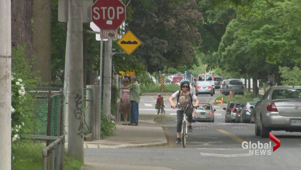
Why the Idaho Stop Keeps Cyclists Safe

gtnh05252015_bikersrunningstopsigns_tnb_2

A few years back we wrote about the magic of the Idaho Stop.  In Idaho traffic laws were revised in 1982 with an innovative bicycle code that allowed  “bicyclists to do a “rolling stop” instead of a dead halt at stop signs~treating the “stop sign” like a “yield” sign. Some cyclists and police officers advocated for an amendment to this law which was passed in 2006. The amendment stated that cyclists must stop on red lights, and must yield before proceeding straight or making a left turn at an intersection. The benefits of the Idaho Stop according to two studies are that safety is improved, and cyclists can move to see around obstacles, lessening car collisions. “

You would think that this aptly named Idaho Stop would just be a good thing for cyclists to practice, keeping themselves safe and at the same time allowing them to review exactly what is happening in an intersection. They are not legal in British Columbia, as many a ticketed cyclist can attest. It is puzzling that the adoption of the Idaho Stop has been painfully slow, with even New York City’s Doug Gordon the co-host of “The War on Cars”podcast wondering why rolling stops are not allowed in T intersections.


https://twitter.com/BrooklynSpoke/status/1117783660239949824

Indeed Oregon is looking at adopting similar legislation to allow cyclists to have leeway approaching a stop sign or a “blinking” red light~ If there are no other vehicles with the right of way, cyclists could legally proceed without coming to a complete stop. Oregon has a champion in the state senate who has brought this concept forward several times.

Senator Floyd Prozanski who is also a cyclistintroduced legalizing Idaho Stops  on April 5 “amending a placeholder bill to serve as a vessel for his idea”. Turns out Senator Prozanski is also the committee chair of the group that will review the bill allowing Idaho Stops, and this means it just might be successful.  Meanwhile Arkansas has just passed laws allowing for Idaho Stops, and Utah is now pondering the same changes in legislation.

Prozanski believes that once  cyclists are legally allowed to do Idaho Stops, the initiative will take off. As the senator bluntly says”“I just think it will do well if we move it forward.” 

You can take a look at this YouTube video below that talks about California turning down the Idaho Stop in 2017. The video also illustrates the history and why the Idaho Stop is effective in keeping cyclists moving and connected. The author also points out that bicycles are not cars, and should not be seen as vehicles from a legislative regulation sense. Is it a  compelling argument?

Slower Streets in Neighbourhoods and Why This is a 21st Century Idea

We have been advocating for slower vehicular speeds in neighbourhoods to make communities safer, more comfortable and convenient for vulnerable road users. I also have been writing about  the impact on communities elsewhere that have adopted 30 kilometer per hour as the default speed in municipalities.

The Scottish Parliament is considering a bill to  lower speed limits to 20 miles per hour (equivalent to 30 km/h) in all cities, towns and villages. That is a reduction from the currently accepted 30 miles per hour (50 km/h). London and several counties in the United Kingdom that have adopted the slower speeds within their city limits have seen vehicular deaths decline by 20 percent, and serious  injury also substantially decline.

City of Vancouver Councillor Pete Fry has introduced a motion asking that Council support a resolution to the Union of British Columbia Municipalities to lobby the Province to amend the Motor Vehicle Act “to a default speed limit of 30 kilometers per hour for local streets with municipalities enabled to increase speed limits on local streets in a case-by-case basis by by-laws and posted signage.” Councillor Fry has also requested that staff identify an area of Vancouver to pilot a 30 km/h speed limit, report back on the strategy, and implement the slower speed in that neighbourhood area to ascertain the effectiveness of the policy.

This is not the first 30 kilometers per hour rodeo going to the Union of British Columbia Municipalities. The City of New Westminster and Councillor Patrick Johnstone headed up such a request a few years back.  What really needs to happen is for this initiative to leave the purview of the municipalities and be seriously considered by Minister of Transportation and Infrastructure Claire Trevena who can give authorization for the change to the Motor Vehicle Act.

The beauty of a blanket implementation of the residential neighbourhoods is that there will not be a huge capital cost to create signage everywhere indicating how fast you can move on which street. While arterial roads would remain at 50 km/h, the local serving streets  within Vancouver  neighbourhoods could  all be 30 km/h.

This is also City of Vancouver City Council’s opportunity to correct the term “Vision Zero”. During the Vision Party’s majority they did not want the term “Vision Zero” in Vancouver’s reports  (which refers to the Swedish approach adopted in 1997 to achieve zero road deaths) to be used for political reasons.

Instead the strategy was called  “Zero Deaths”. Since Vision Zero is the international program that has achieved so much success,it is time to do the right thing and rename Vancouver’s program correctly.

Great Britain’s Rod King has outlined the compelling rationale for slower streets in his presentation to the Scottish parliament:

  1. From an emissions standpoint, a vehicle going 50 km/h requires 2.25 times the energy to sustain a speed 50 km per hour, compared to 30 km/h. A speed reduction to 30 km/h reduces diesel NOxand PM10 pollution by 8 per cent.

  2. The stopping distance required for a vehicle at 50 km/h is nearly double that of a vehicle at 30 km/h. A speed reduction to 30 km/h doubles the available reaction time for everyone involved, increasing the likelihood of avoiding a crash.

  3. The force of a collisioninvolving a vehicle driving 50 km/h is 2.25 times that of a collision at 30 km/h; 80 per cent of pedestrians will die in a 50 km/h impact. At 30 km/h, 85 per cent of pedestrians will survive an impact


Of course there will be lots of pushback from the vehicular lobby which has for a century valued speed and convenience, viewing pedestrian and cyclist fatalities and injuries as unavoidable outcomes of a car first policy. Vancouver has embraced walking,biking and public transit as the transportation policy supported way to get around,

It just makes sense to ensure that residents can walk and cycle within their own neighbourhood without being subject to vehicular crashes at speeds that are in many cases not survivable. As the baby boom becomes one-quarter of the national population, we also need a way to ensure that seniors are fit, have good walking environments and are close to shops and services. Reinforcing the walking environment by slowing vehicular speeds will do that, and will also create a better quality of life.

In the words of Rod King: “If we want consideration for the amenity and safety of residents and communities to be a national norm, then at some stage we have to enter a national debate about the quality of our streets and whether we have rules built around optimising the speed of vehicles, or about the liveability of people. We need to end our thinking about 30mph from our warm, protected, comfortable windscreen view of the street, and consider it from the height of an 8-year-old on the pavement, or with the mobility of an 80-year-old trying to cross the high street to a shop”.

Why Are We So Resistant to Slower Safer Streets?

We’ve written about City of Vancouver Councillor Pete Fry’s motion asking that Council support a resolution to the Union of British Columbia Municipalities to lobby the Province to amend the Motor Vehicle Act “to a default speed limit of 30 kilometers per hour for local streets with municipalities enabled to increase speed limits on local streets in a case-by-case basis by by-laws and posted signage.” Local streets refer to streets within a neighbourhood and not to streets that are arterials or residential collector streets with a yellow line down the center.

Councillor Fry has also requested that staff identify an area of Vancouver to pilot a 30 km/h speed limit, report back on the strategy, and implement the slower speed in that neighbourhood area to ascertain the effectiveness of the policy. That demonstration project within a neighbourhood would give citizens a litmus test of what changes when streets slow, and how pedestrians, seniors, rollers and cyclists might use the street space differently.

This is all well and good, and certainly follows practice internationally where the adoption of slower speeds on streets not only contributes to reduced fatalities and serious injuries. but also creates a new sense of livability, where stick hockey games can happen in the street, neighbours can stroll, and community conversations can occur. In Canada one-quarter of all Canadians will be seniors by 2030, and keeping seniors fit, engaged and active fits into slower streets that encourage walkability. In a place like Vancouver where there is pressure to create more rental housing and forgo some of the amenities that developers are normally asked for, slowing neighbourhood streets provides a low-cost way to enhance public environments. It is simply the right thing to do, and adds an element of safety on dark wintry rainy months.

So it was a surprise when Councillor Fry’s motion was being discussed at Council that a few NPA councillors clearly did not understand that slower neighbourhood streets are not just about fatalities and serious injuries, but  are about making a commitment to a quality of neighbourhood street life in a densifying city.

Given the fact that Council had just heard a presentation on resilient cities and had a motion to have 2/3 of all trips in Vancouver by active transportation or transit by 2030 it just made sense to slow neighbourhood streets. Instead these councillors positionally stated that serious accidents and fatalities did not happen on neighbourhood streets, the kind of conditioned protective response to motordom that has shaped the 20th century.

As Wanyee Li in The Star noted both Edmonton and Calgary are reviewing lowering speed to 30 km/h. Toronto reduced speed in downtown neighbourhood streets to 30 km/h in 2015. Councillor Fry’s motion is elegant in that by  asking the Province to grant municipalities “the power to establish speed limits for a certain category of streets or entire neighbourhoods” it does away with the need to sign each street.

This change to 30 km/h has been proposed before by the City of New Westminster and Councillor Patrick Johnstone a few years back to the Union of British Columbia Municipalities. But perhaps the time has come to be more serious about creating slower streets and more cohesive neighbourhoods.

Adrienne Tanner in the Globe and Mail writes: “Vancouver should follow the lead of other cities and embrace the slow-driving movement. In fact, why not take Mr. Fry’s motion a step further? Let’s dispense with the pilot project and drop the speeds on all residential streets. Even better, the province could take the initiative and save everyone the trouble of pushing for something that so obviously should be done.”

Looking Back at Expo 67 Montreal~”Man and His World” and all that Walking


ebdbcfc711a87226b4deae2ddec62cce


Fifty-two years ago this May Expo 67 opened on two man-made islands in Montreal. The 20th century was about World’s Fairs, and this fair with the theme “Man and His World” attracted fifty million visits in its six month run. At the time Canada’s population was only 20 million people.

Several notable buildings were constructed including Buckminster Fuller and Shoji Sadao’s geodesic dome for the United States pavilion, and Moshe Safdie’s iconic “Habitat” as an example of prefabricated concrete dwelling construction.

habitat67-block1-small3-full

Visitors had “passports” and obtained stamps at various pavilions. People walked from pavilion to pavilion and used the “minirail” an elevated automated system that connected the various areas. In many ways this event put Canada on the international map.

The legacies of the Fair were classic 20th century achievements that included transportation infrastructure:  Montreal’s Decarie autoroute was built, as well as the Hippolyte-Lafontaine bridge and tunnel. But people also got used to walking to a train station that connected them to the two islands and the exhibits, and then used the elevated minirail service for shorter connections.

In many ways it was a fifty year old precursor to how to transport large populations of people in and out of cities in North America. And get those people to walk.

The Montreal Expo baseball team derived their name from the fair, and the former world’s fair site is now Jean-Drapeau Park, named after the mayor of Montreal at the time of the fair.

This YouTube video below highlights the opening of the fair. You may recognize a few of the faces in the video, and enjoy the classic 1960’s camp. There is also  attached a video from British Pathe that shows the built form and design of the buildings and the transportation (the mini-rail)  on the two islands.

Vancouver’s Robson Square, and why it was always supposed to be Walkable

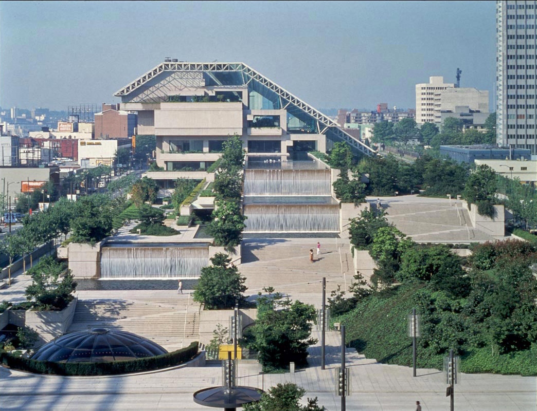
van-shake-0512

Vancouver Sun’s Dan Fumano talks about an interesting perception with the work of the current Vancouver City Council.  Dan was referring to  the council report on the “court house block” of  800 block of Robson Street and the potential decision to approve over five million dollars to create a permanent plaza at this location. You can read the report to Council on this here.

This has been a long talked about initiative and even the architect for the Robson Square court house Arthur Erickson had discussed the closure of this portion of street in the 1970’s. It is not a new idea and it is not something that the previous Vision party  dominated city council dreamed up.  But somehow in the last decade there is a sea change in the way that Vancouverites perceive that work initiated by the City is the “vision” of the ruling party, and not the result of careful reasoned work undertaken over the years by  city staff, who also embark upon extensive public processes to review and comment upon potential plans and projects.

The last Vision party dominated Council contributed to the perception of council as project mavericks by having Council members talk about projects instead of having experienced City staff explain elements of the projects they would have painstaking detail and knowledge of.

While this may have been a well-meaning strategy to give Councillors more media time, it also contributed to a growing distance between policy and the staff people who were actually working on and charged with implementing the policy. The street closure of the court-house block is a prime example of something that was done to connect the street for pedestrians and cyclists, and was a policy direction, not a political council initiative.

As Dan Fumano observes, the pedestrianization of the Granville Bridge and the extension of the subway along Broadway are not creations of the previous Vision council, but were outstanding work objectives from city staff acting upon previously approved city policy.

Back to the closure of the Robson Square block of 800 Robson Street. You can see a  video of broadcaster Jack Webster touring through the Robson Square  park in 1978 when the court house’s public spaces were first opened to the public. Mr. Webster mentions that the old court house was sold to the City “for a dollar” and  still needed renovation to become a gallery. But in the images you can also see how the street functions as a mall connecting space between the old and the new court houses, and how it lends itself to be rethought as a public space for people not  for vehicles. The architect’s intent was that the entire three block area including the 800 block  Robson Street portion be closed to traffic. That was architect Arthur Erickson’s vision four decades ago, and a direction that has been explored by city staff over the years.


People walking to Commercial Areas spend 40% More!

pedestrians

Of course it makes intuitive sense that active transportation users and bus commuters would frequent retail businesses more often than those constrained by  vehicles. But it is always better to have the hard facts on this data, and researchers in the City of London England have done just that.

Transport for London (TfL)  in Great Britain has released a new study  with some staggering statistics about what happens when street improvements are made to facilitate walking and cycling. Time spent on retail streets increased by 216% between shopping, patronizing local cafes and sitting on street benches. Retail space vacancies declined by 17%.  London’s Business Improvement Districts are 90% in favour of more street improvements to facilitate pedestrians, and 85% in favour of better facilities for cyclists.

But the best news, and this is also in line with research conducted in Toronto and in New York City “people walking, cycling and using public transport spend the most in their local shops, spending 40% more each month than car drivers”.

The study for TfL was conducted by a researcher at University College London’s Bartlett School of Planning. Footfall and retail sales in unimproved areas were compared to shopping areas that had implemented improvements such as wider sidewalks, increased outdoor seating, public parks and pedestrian crossings.  Findings showed that retail rents  increased by 7% in improved areas, and office space rents increased by 4%, suggesting that the street improvements translated into much more desirable spaces. You can download the entire report, which also has some great business case references for retail areas  here.

Local business improvement districts in London are also understanding the benefits of increased pedestrian and cycling clientele, with 90% seeing the advantages of pedestrian improvements and 85% wanting more cycling facilities in their area.

Will Norman, London’s Walking and Cycling Commissioner, said: ‘With businesses across London really struggling to survive, we have to do everything we can to support them.‘The evidence is clear – adapting our streets to enable more people to walk and cycle makes them cleaner, healthier and more welcoming, which encourages more people to shop locally.‘The benefits of designing streets around pedestrians and cyclists and reducing car use can be enjoyed by everyone and will help ensure the future of our high streets.’

And of course, more pedestrians and more cyclists on separated facilities, improved street design and slower speeds make roads safer and encourage travel to retail businesses by active transport, and make retailers more money.  This BBC video below has been just released talking about Vision Zero and how to make the streets of London safer for everyone.

Perfecting the Pedestrian Glare

h2b1x9d

As only The Onion can report, they have narrowed down how pedestrians can stay safe crossing roads. While it is a spoof, it is telling.

Pedestrian  Adam Hartsell in Chicago “reportedly made sure to look up at the driver of an approaching vehicle Thursday to ensure they would feel extra guilty in the event they failed to stop and ran him over. “

The 26-year-old pedestrian has two approaches walking across intersections~ he “emphasized the importance of not only locking eyes with each and every oncoming driver, but also delivering a hard stare that conveys a stern moral appraisal of any who would not brake their vehicle in time. “

“In this way, I will be able to haunt their dreams long after they’ve struck and killed me. If I have enough time, I also make sure to look any passengers dead in the eyes, so that they, too, will be hounded for years by debilitating remorse. It’s important to take these small precautions.”

Like “Bird Droppings” Scooters Impede Walkability

GettyImages_997200426

When talking about pedestrian environments I am referring to walkable, inviting places that include the most vulnerable in our communities~the very young, the disenfranchised, those with mobility challenges, and the elderly. This is accessible mobility for everyone in the pedestrian environment.

Why is it so challenging to maintain good walking environments with smooth, continuous sidewalk, curb cuts correctly formed in the right locations at intersections, lots of visual interest and places to go to and through? Why do these pedestrian environments, which are proven to be great for enhancing retail’s bottom line seen as an add on in Council reports, instead of having their own distinct plan?  Enhancing accessible walkability keeps communities fit, connected, social, and wards off a host of mental and physical disease, and are sustainable. Research done by  the esteemed Dr. Larry Frank at the University of British Columbia shows that even people in suburban communities want to live close to schools, shops and services, and will accept a smaller house size to live in those kind of communities.

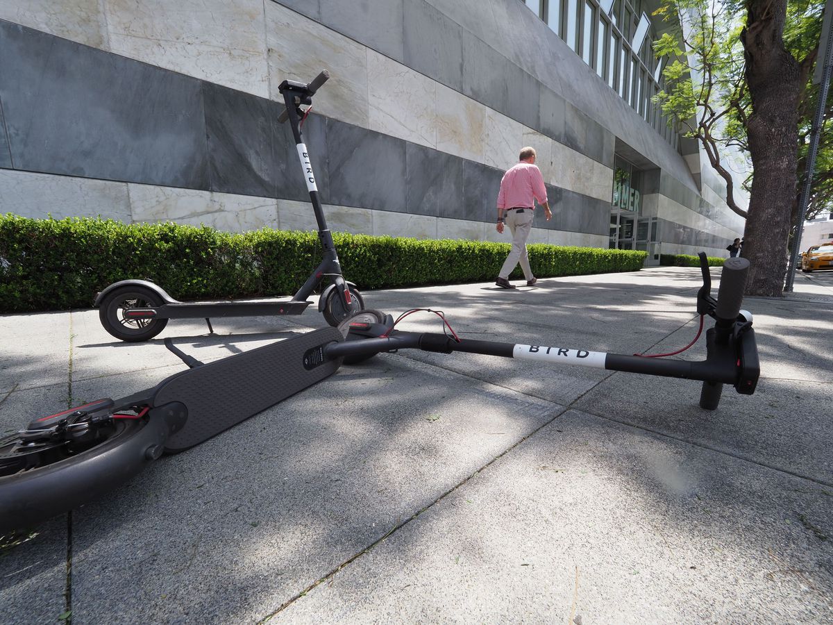
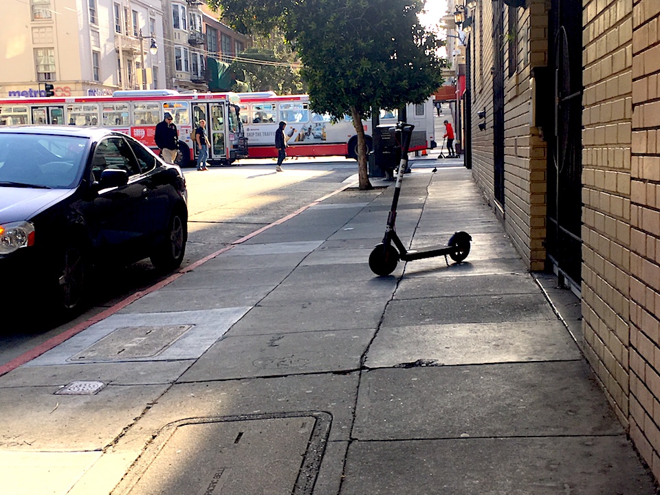
That is why it is so important to stay ahead of trends such as  dockless scooter rentals which are relatively cheap to rent, and can be abandoned when able-bodied riders can get to their destination. Wheelchairtravel.org says it best:  “These next-gen “Bird droppings” litter America’s sidewalks and frequently block wheelchair users’ independence and freedom of movement.”

For sidewalk users who do not have the ability to go around  these items or are thwarted in moving them, scooters are a huge problem. Children, seniors and people with vision impairment will have these items as a trip hazard.

“Now is the time for local governments to regulate the conditions of their use and placement. Stiff penalties for blocking sidewalks should be instituted and riders prohibited from operating scooters on sidewalks. Safety is as much a concern as accessibility”.

Go and take a look at what has happened in San Francisco. I have written about  how scooters now litter public places and how important it is for the City of Vancouver to get ahead of the curve and ensure that regulation is in place to limit scooters from littering the sidewalks.

Those regulations need to be strong~in Austin Texas the scooter company has four hours to move a scooter blocking the public sidewalk right of way. That is too long. I was in Zurich last summer where strict regulation means no scooters can be parked on any public sidewalk or pedestrian place anytime.

This also comes back to the importance of recognizing the public sidewalk system, with its complexity of users of differing abilities as worthy of having its own standing committee of Council, reviewing each and every report that impacts the walkable public realm. It is time to recognize and embrace accessible walkability as the foundation to community making, and recognize that accordingly in our municipal committees.

scooter_on_post_stImages Vox.com Hoodline.com

Paint and Bollards and Presto~Traffic Calming!

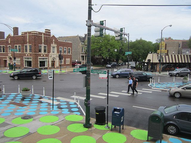
We’re seeing more and more examples of cities and neighbourhood groups just getting it done on streets with cans of good latex paint.

There is absolutely no doubt that paint is the most inexpensive way to change the nature of the street, expand pedestrian refuge areas, and make crosswalks more visible for pedestrians and vehicles alike.

In her groundbreaking book Streetfight, Janette Sadik-Khan points out that making infrastructure for pedestrians and cyclists makes good economic sense, contributing to the street life in the city. She also argues that everything New York City needed in order to create 60 pedestrian plazas, 180 acres of new public space and 400 miles of bike lanes was all in the city yards — paint, bollards, and cement planters.

That’s why it’s wonderful to see NYC’s examples of paint-and-planters replicated elsewhere.

In Bukchon-Ro in Seoul, a traffic circle was painted in the middle of the street, separating this historic area from a commercial district. Simply painting this image caused vehicles to proceed more slowly and enabled the many pedestrians — visiting local galleries, tea houses and cafes — to cross more safely. Paint established “pedestrian priority streets”, and has helped make the streets more walkable and lively.


The town of Mandan, North Dakota, with a population of 22,000 and located just across the Missouri river from the state capitol of Bismarck, is doing the same thing. City planner John van Dyke got it right by installing three temporary painted traffic circles at intersections, calling it a “demonstration project”, and inviting public response to the changes.

Mandan also added temporary curb extensions using bollards to make a shorter crosswalk distance for pedestrians. You can see the reporting of the local news station on the temporary traffic circles here.

images-sandy james & pininterest.com

Giving Pedestrians the “Green Man” Priority in London

tfl-diversity-lights-2

As part of Mayor Kahn’s plan to increase daily walking trips in London from 6 million to 7 million by 2041,  the City of London is looking at how to make walking safer, comfortable and more convenient for walkers.  While adjusting signals to give pedestrian more “green man” time at signalized intersections,  staff will also be using “SCOOT”.

SCOOT stands  for “Split Cycle Offset Optimization Technique” which will be installed at ten intersections to give pedestrians priority. The city of London is on a mission to make walking as convenient as possible, using smarter traffic signals that reduce wait times for pedestrians. These smart signals ” can detect the number of pedestrians waiting at an intersection and automatically adjust timing to minimize their wait and ensure they have enough time to cross” according to Streetsblog.

And here’s the cool part~the “Green Man” initiative allows for a continuous pedestrian green signal until vehicular traffic is near, when pedestrians are then given the red signal. The technology has been tested by Transport for London on two streets with only bus traffic prior to this wider rollout, and was very well received by pedestrians. This is all part of the London Walking Action plan which can be viewed here.

crossing_2209318k