Category Archives: Enhancing Safety for Pedestrians

Do Flags at Intersections Makes the Streets Safer? Halifax Thinks So.

coast-crosswalk-1

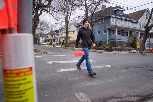
From Halifax Nova Scotia,  The Globe and Mail reports on the “Crosswalk Safety Society” that are placing “high-visibility flags” on crosswalks where there are no crossing lights and no safety features. While staff at the Halifax Regional Municipality urged Council to get rid of these flags and create safer pedestrian crossings, council voted to continue with the flags being available at those crosswalks. And these flags are not inexpensive, with the Crosswalk Safety Society shelling out $250 to outfit each crosswalk with them.

Only 2 to 6 percent of pedestrians use these flags to wave at cars when they are crossing, and when a reporter watched an intersection for two hours, pedestrians did not use the flags at all.

The concept of intersection flags have been tested in Berkeley California and in Seattle and were dismissed as being ineffective and giving pedestrians a fake sense of confidence. It also puts the onus on the pedestrian for getting the driver’s attention and stopping a vehicle, something that should be the responsibility of the driver.  For small children, using flags is one more thing to take attention away from the important task of simply safely crossing the road.

Kudos to municipal staff in Halifax that conducted their own tests at two intersections, crossing each of them three hundred times.  “They found that drivers gave way 94 per cent of the time when flags were being carried and 89 per cent of the time at crossings where there were no flags. Driver compliance was lowest, at 86 per cent, when flags were present but not carried”.

No matter what the political reasons are for allowing a group to place flags on crosswalks, that  does not address the issue of making the street safer for pedestrians to cross. CityLab explored flags and crosswalks four years ago and concluded that asking people to carry a flag when crossing a street does not put the pedestrian first. Fort Lauderdale tried this as  “a multipronged effort to improve drivers’ awareness of laws that require them to stop at marked crosswalks”. 

What does it take to change driver behaviour at crosswalks? CityLab reports that an observational study by Active Transportation Alliance showed that only 18 percent of drivers stopped for pedestrians at marked crosswalks. Flashing lights and raised or textured crosswalks raised the stopping rate to 61 per cent. This study was done in Chicago where Illinois law requires vehicles to stop for pedestrians crossing the road.

Why do drivers not stop at crosswalks? CityLab suggests that it is not only the way streets are designed to encourage traffic flow, but also that people “don’t walk very much themselves. They don’t project themselves in the pedestrian’s frame of mind when they’re driving, because they are rarely in the pedestrian’s position at any other time.”

That response suggests that as sustainable cities encouraging aging in place and supporting active transportation that more education, enforcement of driver behaviour and speed, and better street crossing design is needed to keep the most vulnerable road users-pedestrians~safe and walking.

Unbelievably the City of Cupertino California has a video showing how flags are to be used while crossing a  street on the way to school.No surprise that the “thumbs up and down” buttons and comments have been disabled on this video.


San Francisco Shrinks Fire Trucks as a Response to Vision Zero

neworleansfiretruck


In designing streets for all users and throating down vehicular traffic people often ask if emergency vehicles and fire trucks can navigate the newly designed spaces easily and quickly. There are approved geometric design guides, as well as software programs to ensure that these vehicles can manoeuvre more constricted spaces easily. And now all fire trucks don’t need to be built to the old specifications either. This story from Streetsblog describes Fire Engine 13 in San Francisco’s Financial District that is “narrower, not as long, and has a better turning radius,” said San Francisco Fire Department Chief Joanne Hayes-White. “It’s a beautiful piece of equipment.”

Eight new fire engines in San Francisco are ten inches shorter than the standard older trucks and can make a u-turn in 25 feet. The shorter design enables the engine to manoeuver San Francisco’s curving streets. The engines also include on board cameras to give a full 360 degree view around the engine, enhancing safety for cyclists and pedestrians, following the Vision Zero edict every life is precious.

All eight of the new engines are expected to be in service in December. The new fire engine is actually in response to City Hall Supervisor Scott Weiner requesting that the trucks  be designed to fit the city, instead of the city streets being designed to fit a certain size of fire truck. Both Walk San Francisco and the San Francisco Bicycle Coalition collaborated on the design.

Each engine cost over $500,000  American dollars and are anticipated to run for 15 years. The engines will go to “stations that respond to calls in the densest areas of the city, with the most alleys and narrow streets, such as Chinatown and the Financial District.” 

San Francisco is also looking at replacing their aerial ladder trucks with a design that can work over parking protected bike lanes and other street amenities. Sometimes it is just better to change the size of the service vehicle providing much-needed emergency services than to overbuild streets for the infrequent emergency event.

strongtowns-2-838x0_q80-650x0_q70_crop-smart

Coming Up~Crossing the Street Can Kill You in Vancouver’s Winter Months

15505995_g

Vancouver is in an unusual situation. Unlike most large Canadian cities we do not normally get snow and live in a habitat with  lots of tall trees and a lot of rain. These factors make walking in Vancouver’s low light winters a challenge. Snow does provide some light bounce, and does make cars go slower.  In 2016 nearly one pedestrian a month was killed on the City of Vancouver streets. Most were over 50, and most were men. The majority of pedestrian deaths in the Province died while legally crossing the road in a marked intersection.

An interview  by the CBC  points out that 40 per cent  of all pedestrian deaths in the Province occur in November, December and January. Of that amount 61 per cent were over 50 years and more than one-third were over 70 years of age. The 2017 numbers for pedestrian deaths are not released yet  from the B.C. Coroners Service for the Province. Price Tags has recently written about the fact that pedestrian signal crossing time  is not long enough for many seniors, and that the standard crossing times for the elderly  are being internationally challenged.

On a per capita basis, Vancouver has a worse record of killing pedestrians than the City of Toronto which is actively campaigning to reduce road violence. “A recent survey released by ICBC revealed that nine out of 10 drivers worry about hitting a pedestrian at night, particularly in wet weather, while eight in 10 pedestrians don’t feel safe in those conditions.”

The Provincial Medical Health Officer has written Where the Rubber Meets the Road trying to halt the 280 annual  deaths (47 in Metro Vancouver)  from automobiles in the Province, and the 79,000 who are injured. Vulnerable road users, those using active transportation have increased in fatalities, comprising 34.9 per cent of all fatalities in 2013. Road design, speed, driver behaviour and visibility are all aspects of road safety and achieving Vision Zero as set out in Europe. The safety of vulnerable road users is now a public health priority in British Columbia and in Toronto, and we need to design our streets and slow down vehicular speeds as if every road user’s life truly does matter.

Because pedestrian deaths in the City of Vancouver are simply not acceptable.

vancouver-pedestrian-safety

Navigational Apps Turning Quiet Walking Streets into Carmegeddon

screen-shot-2017-12-09-at-20508-pmjpg-1b3f8fee272a5292


You may relate to this. In a Delta neighbourhood there is a  residential street that  is the shortest distance between two arterial roads, favoured by GPS apps, tradesmen and taxis and is a block shorter for arterial short-cutting  cars.There are no sidewalks, no indication that pedestrians are walking on the street which includes a blind corner on a hill with no pedestrian clearance. At 50 kilometers per hour the inevitable has happened, with high traffic volumes and speeds resulting in the killing of a neighbour’s dog, one transmission gutted on a front lawn and cars ending up in neighbours’ yards and through their hedges. Add in a few nearby “golf” communities where older seniors drive to services in their garaged polished cars at speed through this  residential street to get to an arterial. The fact it is a residential local  street and that short cutting should not be happening is not of interest to the GPS apps or drivers, and puts local walkers and cyclists  at risk.

Kudos to  Leonia New Jersey (across the Hudson River from New York City)  which realized that these “alternative routes” don’t just manifest themselves in driver behaviour, but are also suggested by services like Google Maps, Waze and Apple Maps. As the New York Times  notes these apps have resulted in traffic-choked towns where people have been circumventing traffic and choosing shorter routes due to GPS services.  And Leonia  has had enough: “In mid-January, the borough’s police force will close 60 streets to all drivers aside from residents and people employed in the borough during the morning and afternoon rush periods, effectively taking most of the town out of circulation for the popular traffic apps — and for everyone else, for that matter.”

“Without question, the game changer has been the navigation apps,” said Tom Rowe, Leonia’s police chief. “In the morning, if I sign onto my Waze account, I find there are 250,000 ‘Wazers’ in the area. When the primary roads become congested, it directs vehicles into Leonia and pushes them onto secondary and tertiary roads. We have had days when people can’t get out of their driveways.”

The Waze app uses crowd sourcing to update its information which has resulted in some neighbourhoods “fabricating accidents” to stop the flow of motorists using the app. While defending the app’s right to reroute vehicles from congested roads to residential streets, Waze also says it “shares free traffic data with municipal planners nationwide”, as if the good of more vehicle planning outweighs the rights of residents to the safe and comfortable use of their street. Indeed Waze says that if a road is “private” it will not be used by the app. How many “private streets” in your community?
Unlike other communities that have installed turn restrictions and speed humps, Leonia’s approach has been proactive against congestion and short cutting caused by apps. Residents will be issued special tags for their cars, and other users of the street will be fined $200 in the rush hours. The police department has notified the major traffic and navigation apps of the changes and fully intends to enforce local use of their streets. While other elements like traffic barriers or street closures are the more preferential way to keep traffic out, the approach taken is a policing one.  As the Chief of Police of Leonia says “It’s basically all or nothing . It’s a very extreme measure for very extreme traffic. Would I prefer not to do this? Of course. But I would rather try something and fail than not try anything.”


navigation-app-car-shutterstock-700px

Putting Alarms on Pedestrians to make Autonomous Vehicles “Safer”

pedestrian-crosssing-measures


It is really hard to believe that a group of researchers would be examining this issue, and even harder to fathom that Elsevier chooses to advance this through their social media and on-line presence.  But here it is~in this article by several French researchers at the aptly named “French Institute of Science and Technology for Transport, Development and Networks, Laboratory for Road Operations, Perception, Simulators and Simulations”  researchers in Versailles actually created a pedestrian dog collar.


Using vibrotactile technology on wristbands that vibrated on pedestrians’ arms when vehicles were approaching,  57 participants were asked to cross a two-way traffic street. Senior pedestrians  are overrepresented in fatal traffic incidents, with the researchers surmising that this was because older people have  “gap” challenges, unable to ascertain the speed of approaching traffic. This same inability to judge traffic speed when crossing a street was discussed in this Price Tags Vancouver post from last year, where researchers found that children under 14 years of age did not have the perceptual judgement or motor skills to safely cross the road.


While the researchers found that the percentage of pedestrians being crashed into by simulated cars decreased, “collisions did not fall to zero, and responses that were in accordance with the wristband advice went up to only 51.6% on average, for all participants. ”  


While the vibrating wristband was shunned by younger participants as something they would ever use, “behavioral intentions to buy and use such a device in the future were greater in both groups of older participants.” This device only reduced by fifty per cent the likelihood of pedestrians being crashed into by vehicles. But as the researchers conclude “This haptic device was able to partly compensate for some age-related gap-acceptance difficulties and reduce street-crossing risks for all users. These findings could be fruitfully applied to the design of devices allowing communication between vehicles, infrastructures, and pedestrians.”


New Zealand Civil Engineer and Phd Candidate Bridget Burdett  summed up this study and its proposed use with automated vehicles  below.

IMG_3763

Traffic Calming in the Suburbs of London England

residential20street20with20modal20filter2028source20lb20waltham20forest20mini20holland20bid29


An interesting way to change the nature of traffic is written in this article by The Standard. Imagine  Walthamstow England (in East London)  which introduced partial road closures along twelve main roads. Traffic which was over 20,000 vehicles per day was cut by 50 per cent. The aim of the project was to reduce short cutting through the neighbourhoods, making roads safer for pedestrians and cyclists.
This project was part of  past Mayor of London Boris Johnson’s plan to bring cycling culture to  the suburbs, with 30 million pounds available to run these types of projects in Waltham, Kingston and Enfield. And surprise! “Traffic evaporation” occurred, where fewer trips were taken by car and less rat running happened in neighbourhoods.

Collisions were also reduced with none being reported after the partial closures, compared with 15 in a three-year period.  The project was backed by local residents but had some pushback from some businesses that feared it would reduce their commercial trade. The “full results — including an expected large increase in the number of people cycling and walking — will be released by the council early next year.” 

And the take away? As Simon Munk of the London Cycling Campaign observed ““It’s very clear that this is a replicable approach and other areas can do it. There is not some kind of ‘magic dust’ that means only Walthamstow can do it…It doesn’t cause chaos, despite what some people say. It’s capable of making our town centres and city centres, and communities where people live and work, work much better.”


img_1245600by400

When Autonomous Vehicles Kill Pedestrians

bosch-autonomous-car-technology_100417251_l


With a death of a pedestrian the seemingly relentless march forward of autonomous vehicles has taken a pause as reported by the New York Times.  From a legislative standpoint autonomous vehicles (AVs) are operating in a piece meal legal environment, and the state of Arizona was an early adopter, inviting these vehicles  to be tested on the state’s road network in a “regulation free zone.  “Then on Sunday night, an autonomous car operated by Uber — and with an emergency backup driver behind the wheel — struck and killed a woman on a street in Tempe, Ariz. It was believed to be the first pedestrian death associated with self-driving technology. The company quickly suspended testing in Tempe as well as in Pittsburgh, San Francisco and Toronto. The accident was a reminder that self-driving technology is still in the experimental stage, and governments are still trying to figure out how to regulate it.”


The Uber car, a Volvo XC90 sport utility vehicle outfitted with the company’s sensing system, was in autonomous mode with a human safety driver at the wheel but carrying no passengers when it struck Elaine Herzberg, a 49-year-old woman, on Sunday around 10 p.m. Sgt. Ronald Elcock, a Tempe police spokesman, said during a news conference that a preliminary investigation showed that the vehicle was moving around 40 miles per hour when it struck Ms. Herzberg, who was walking with her bicycle on the street. He said it did not appear as though the car had slowed down before impact and that the Uber safety driver had shown no signs of impairment. The weather was clear and dry.
There has been early discussion on the computer based “ethics” of the autonomous vehicle, and the fact that the vehicle was being designed to save its occupants first. Autonomous vehicles have been hailed as way to stem the annual deaths of over 37,000 (2016 figures) people on the road by safer, logical control. But the technology is only a decade old, and “now starting to experience the unpredictable situations that drivers can face.”


“This tragic incident makes clear that autonomous vehicle technology has a long way to go before it is truly safe for the passengers, pedestrians, and drivers who share America’s roads,” said Senator Richard Blumenthal, Democrat of Connecticut. While autonomous vehicle testing has temporarily halted with this death, investigators  are examining what led to this vehicle’s failure to recognize the pedestrian. Vehicle developers have expressed challenges in teaching the systems to adjust for unpredictable human behaviour. As a professor at Arizona State University expressed “We’ve imagined an event like this as a huge inflection point for the technology and the companies advocating for it,” he said. “They’re going to have to do a lot to prove that the technology is safe.”


ford-fusion-hybrid-autonomous-research-vehicle1

The Day that Sweden Switched~”Dagen H”

a-fascinating-history-of-dagen-h
Walk Metro Vancouver knows that change is hard. But if you are an entire country and you can educate, plan, and change roads to get folks to drive on the other side, can we not make the same case for a great education, speed, and road design model to make walking safer and more convenient?

On September 3, 1967, a nation-wide change occurred in Sweden that you may not have heard about, one that informs how road congestion charges and the Vision Zero philosophy were developed in that country.
On that day fifty years ago, every Swedish driver and cyclist changed from driving on the left side of the road to the right side. As the BBC reports, “the day was officially known as Högertrafikomläggningen (right-hand traffic diversion) or simply Dagen H (H-Day). Its mission was to put Sweden on the same path as the rest of its continental European neighbours, most of which had long followed the global trend to drive cars on the right.”

Using planned logistics and an education campaign,  every city and town had to repaint road markings, replan the locations of bus stops and lights, and reconfigure intersections, bikeways and one direction streets. Cities such as Stockholm, Malmö and Helsingborg used the “right side drive” campaign to increase buses by retiring tram lines, and started the conversation about traffic safety.
Signage had to be changed across Sweden, with the military assisting with that task. To facilitate the signage switch, all traffic except for emergency and essential services was banned. (From 1950 to 1966, fatal road crashes had increased over 100 per cent, to 1,313 in 1966.)
Remarkably, the change to driving on the right side of the road went pretty smoothly.
While “H-Day” was on a Sunday, only minor accidents occurred on the first Monday going back to work, and there were no fatalities.

As the changes caused Swedes to drive a bit more cautiously, traffic deaths decreased by nearly 18 per cent, and injuries were reduced by 11 per cent. “Investment in the planning and logistics” was credited for making the difference, as well as communication initiatives designed to educate the public and get them to comprehend the change.

Billboards, and even milk cartons, carried information on the change. “There was even a theme tune to accompany the switch, reaching number five on the Swedish hit parade.” 
Thirty years later, in 1997, Sweden commenced an international project to work towards Vision Zero, accepting no fatalities on their public roads. The statistics are fascinating — Sweden has one of the lowest road death statistics, with “270 people dying in 2016, compared to 1,313 in 1966, the year before Dagen H.”  

By prioritizing walking, cycling and transit, Sweden is already operating self-driving transit buses in Stockholm and planning for the impact of autonomous vehicles. They are also forecasting a future where few people in Sweden will need to drive at all, with an abundance of active transportation and transit alternatives.
An intensive public process and the exchange of ideas and information is seen as key to this transition to driverless options, increased use of transit, and technological change.
YouTube provides this Universal Newsreel coverage of the 1967 switch to the right side of the road.


Electric Scooters Inundate San Francisco!

sf-bird_-0307

If you have been in San Francisco  California in the last few weeks  you have probably seen them-electric scooters are everywhere. And as discussed by a reporter for the New York Times section California Today  in San Francisco “Shared electric scooters are available to reserve and rent by app for as little as $1 a ride. They are billed as a way to “help make transportation better and more environmentally friendly” by one start-up, Bird, which has netted $100 million in venture capital funding.”


The scooters run by three companies appeared after Saint Patrick’s Day  and are leased by unlocking them with a mobile cellphone application. It costs one dollar to unlock the scooter, and fifteen cents a minute to use it. Reporter Mike Issac found that the dockless nature of the scooter means they are parked just about anywhere.  San Francisco was blanketed with scooters in advance of any legislation existing under the city’s transportation code. The city attorney has acted quickly to bring in regulation, but not for the reasons you would think-the City is worried about the stand-up ride share scooters being a “trip hazard”. “The scooters, capable of speeds up to 15 mph, appeared suddenly, and since their arrival, they’ve drawn praise from early users and a flood of complaints from people who don’t like one of the slender two-wheelers’ biggest features: They can be parked anywhere.” 

The scooters have achieved quick action from the City as sidewalks have become “dumping grounds” and the City is ” “examining all of our legal options to protect the more than 1 million people who use San Francisco’s sidewalks every day.” They are piled up when parked, often blocking sidewalks and bikelanes, and are hazards for people with disabilities. Places like Austin Texas and Santa Monica impound scooters left on sidewalks.  San Francisco wants to regulate the scooter sharecompanies and have them obtain operating permits.
Under State law you cannot ride a scooter on a sidewalk, you must wear a helmet and you must be over 18, rules that the local San Francisco police can enforce. But locations for parking the scooter at the start and end of each trip needs to be worked out. As one local stated about the use of sidewalks “We don’t want people using motorized devices on the one safe place to walk.”


16006311_g

1,000 Crashes a Day in British Columbia~Time to Get Serious About Stopping Them

coquihalla-crash

Two items from the Insurance Corporation of British Columbia (ICBC), the provincial Crown Corporation responsible for driver licensing, registration and primary insurance coverage, came out yesterday.

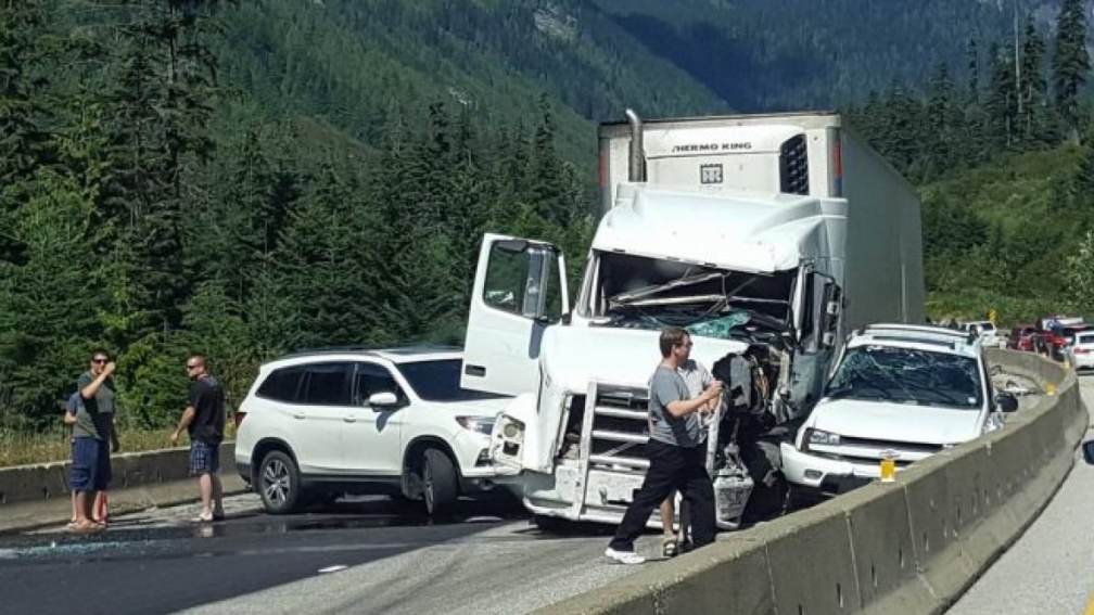
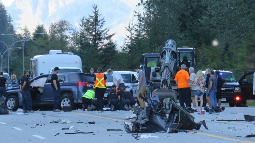
If you’ve felt that driving in BC was getting a bit more dangerous, you’re right. ICBC has confirmed that, in 2017, there were 350,000 crashes province-wide. Think of that number — that means there were almost 1,000 crashes every day last year. Statistically, this also suggests (conservatively, assuming single-car crashes) that about one in every ten drivers will be involved in a crash this year.

That figure of 350,000 crashes also works out to 40 crashes every hour in the province; overall, this costs ICBC $4.8 billion, or roughly $13 million per day.

This is also $1 billion more than the cost of the proposed 10-lane Massey Bridge (last estimated in the $3.7 billion range).

ICBC released a short statement acknowledging the sad reality — that vehicular crashes have increased by 25 per cent in the past four years. Walk Metro Vancouver has previously written about the ground breaking work of  recently retired Provincial Medical Health Officer, Dr. Perry Kendall, who identified car crashes as a major cause of death in his 2016 report “Where the Rubber Hits the Road”.

In 2011, nearly half of all serious crash injuries were not to people in cars, but to vulnerable road users — those without a steel frame for protection. In terms of fatalities, vulnerable road users were 32 per cent of all mortalities in 2011, increasing to 35 per cent in 2013.

Here’s the other bottom line. In our province, about 300 people are killed each year on the roads, give or take a few dozen. Three factors have been proven to contribute to fatal crashes: speed, driver distraction and impairment (drugs, alcohol), and the built environment (road design and construction).

Two of these factors can be dealt with immediately. Road speed can be addressed by increased enforcement and notification of enforcement, as has effectively been done by the Delta Police Department, within their jurisdiction. Speeds to and from the ferry in Tsawwassen along Highway 17 have been noticeably down since the police blitz. On Vancouver Island, the regional district is asking the Province to install point-to-point speed cameras on the Malahat Highway, a particularly dangerous road.

In the 21st century  speed enforcement by camera should be thought of  as a safety precaution assisting safe travel, instead of a governmental cash grab. That financial inference might be solved by having fines placed into a fund assisting victims of car crashes.

The second factor, driver distraction and impairment, can also be addressed by education, such as the courses delivered by ICBC, enforcement, and stricter penalties for driver distraction. Changes in road design are clearly in the Vision Zero mandate of moving towards a target of no deaths of any road users, and those changes need to be made to ensure that vehicles travel at the posted speed, and not above.

In a province that has universal health care and universal vehicular insurance, it just makes sense to ameliorate the high crash rate and to save road users from serious injuries and death.

It’s time to think of changing road design to drive to posted speeds, and emphasizing driving for safety, not for quick arrival.  The ICBC crash statistics call for a drastic new approach to road safety that begins now.

hope-crash